EmbeddingGemma 2: an open, lightweight multimodal embedding model
deepmind.google·6d ago
TL;DR
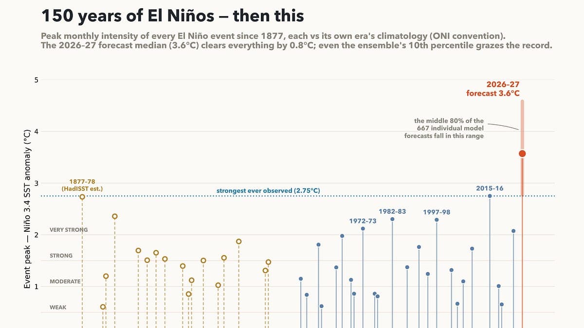
Current models predict that the ongoing El Niño event could be the strongest on record, with sea surface temperatures in the Niño 3.4 region expected to peak at 3.6C. This surpasses the previous record of 2.75C set during the 2015-16 event by a significant margin.
✦ Why It Matters
Monitor weather forecasts closely to prepare for potential extreme weather events linked to this El Niño.
Key Takeaways
Full Summary
Recent forecasts indicate a 90% chance that this year's El Niño will surpass all previous records, with a projected peak sea surface temperature anomaly of 3.6C in the Niño 3.4 region of the tropical Pacific. This is significantly higher than the previous record of 2.75C set during the 2015-16 event.
The models show strong agreement, with 91% of ensemble members predicting temperatures above the 2015-16 peak. Observations reveal that current sea surface temperatures are already around 2C above average, suggesting further intensification is likely.
The implications for global temperatures are concerning, as the effects of this El Niño may lead to 2027 being the warmest year on record. However, caution is warranted, as these models have never been tested in this extreme range.
Related