Agentic data science with the Data Agent Kit
cloud.google.com·7h ago
TL;DR
A new GeoJSON map viewer was developed to display local political boundaries and export them as PNGs. This tool leverages AI to generate accurate GeoJSON files from government data sources.
✦ Why It Matters
Start using AI tools to generate and visualize GeoJSON files for your local projects today.
Key Takeaways
Full Summary
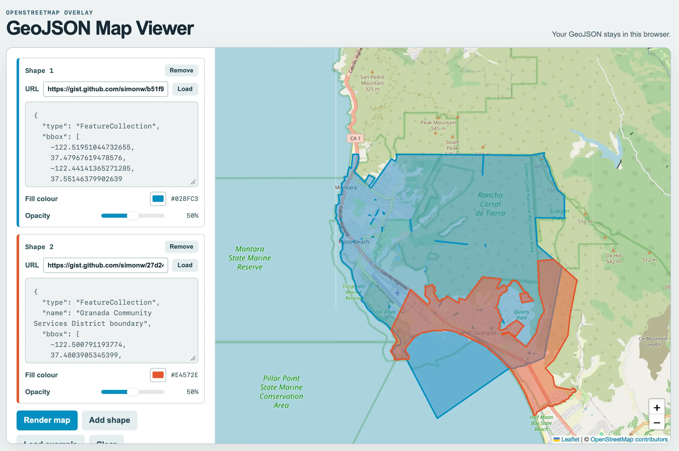
While assisting in gathering maps for local political boundaries, a need arose to visualize GeoJSON files effectively. Using GPT-5.6-Sol, a custom tool was created that allows users to display and export these boundaries as PNG images.
The development process involved iterations with Claude Code for web and Fable 5.1, resulting in a functional map viewer. Notably, ChatGPT Work can extract and combine government data to generate precise GeoJSON files for various regions.
For instance, users can request specific boundaries, such as those for the El Granada Community Services District or the Midcoast Community Council near Half Moon Bay, CA. The tool not only simplifies the visualization process but also enhances accessibility to important local data.
Related